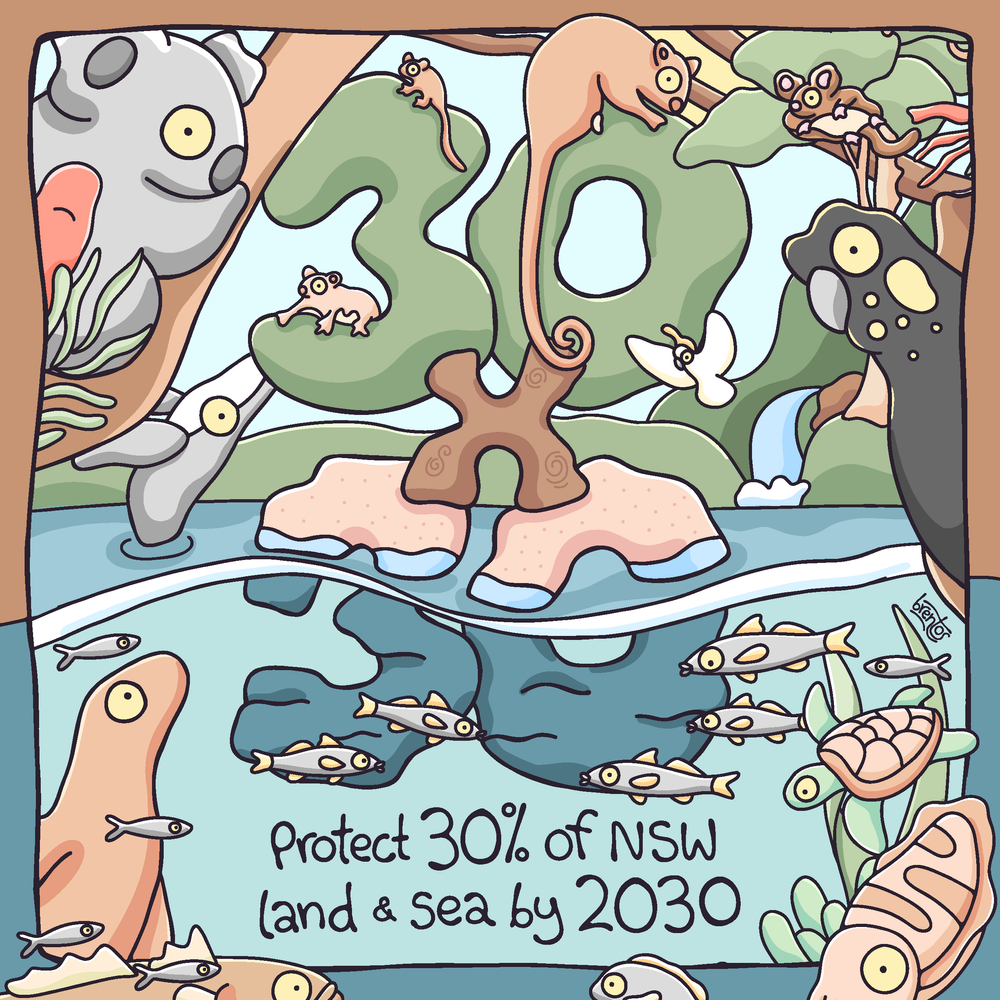
Help protect 30% of
NSW’s Land and Sea by 2030
SUBMISSION GUIDE
Help improve protection for our Marine Parks Network
At the end of July the Australian Government will give notice of intent to prepare new draft management plans for the marine park networks in the Temperate East, South-west, North-west and North marine regions and the Coral Sea Marine Park. The new plans will replace those released in 2018 that are due to expire in 2028.
The Government will invite public comment giving us a statutory 60-day consultation period to make submissions in support of improving marine protection in Australia’s marine estate by expanding the number and size of highly protected marine sanctuaries or National Park Zones (NPZs) to protect marine life and their habitats from mounting pressures like climate change and industrial fishing. The Australian Government will use the new marine park network management plans to deliver its commitment to give high level sanctuary protection to at least 30% of Australia’s oceans by 2030.
Now is the best time to influence the Government’s planning on the new Temperate East Marine Parks Network Management Plan.
You will be able to make your submission online through the Department of Climate Change, Energy, the Environment and Waters Have Your Say Portal or via email.
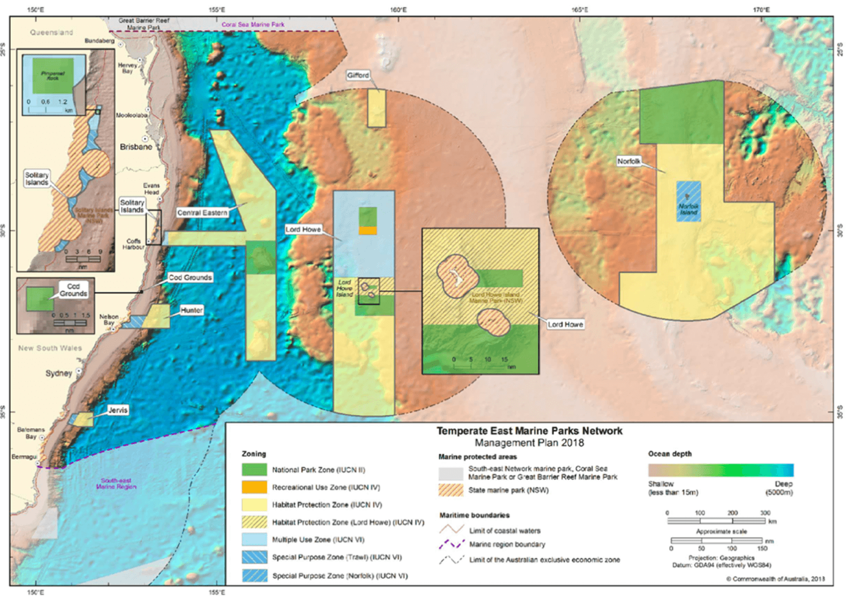
Figure 1 The current Temperate East Marine Parks Network Management Plan 2018 with management zones
Key points to make in your submission
Five ocean currents collide in the Temperate East Marine Region, creating a very special mix of tropical, sub-tropical and temperate marine species. Upwellings at the many canyons and seamounts attract tuna, whales and seabirds, while coral and rocky reefs provide critical habitats. A third of the region’s marine species are found nowhere else in the world. Yet the region has extremely low marine sanctuary protection at 1.3%.
Expanding marine sanctuaries is crucial for safeguarding its unique marine life.
Lack of protection: Only 4% of the marine region is covered by NPZs, which is way too low to give proper protection to the region’s special values. Although there are four marine parks on the continental shelf, only two tiny areas - the 4km2 Cod Grounds Marine Park and the 2km2 Pimpernel Rock Marine Park, has any NP. The continental shelf supports the region’s highest marine biodiversity, but all but two of the NPZs in the network are well offshore.
Increasing pressures: Oil and gas industry impacts, like seismic testing and extraction, are allowed in five of the eight parks, while pipelines are possible in all zones of all parks. Under the current management plan, bottom trawling can occur in three of the eight parks, and midwater trawling in seven of the eight parks. Demersal gill netting could also possibly occur in six of the eight parks, and pelagic in seven, while demersal and pelagic longlining could be allowed in six of the eight parks. The independent Fisheries Gear Risk Assessments commissioned by the Australian Government identified these fishing practices as incompatible with marine park values.
The region is facing increasing pressures from coastal urban and industrial development, climate change impacts (including shifts in major currents), commercial and recreational fishing, and increased shipping and port activities.
Once in a decade opportunity: The Government’s review of the current Temperate East Marine Parks Network management plan provides the opportunity to address some of the critical shortfalls in protection of the outstanding marine life of the region.
Economic values and jobs: Marine sanctuaries underpin Australia’s world-class dive and nature-based marine tourism industry. The Temperate East Marine Parks Network includes some of Australia’s premier dive destinations, including Lord Howe Island, the Solitary Islands and the Cod Grounds, renowned for their southern coral reefs, unique underwater landscapes and abundant marine life. Australia’s recreational scuba diving industry contributes up to $4.2 billion annually to the economy, and expanding National Park Zones would help protect the marine life and ecosystems that attract visitors, support regional tourism businesses and sustain local jobs in the Temperate East region.
Marine Parks based on science: Scientific consensus establishes that protecting at least 30% of the world's oceans by 2030 (the "30x30" target) is the bare minimum required to halt biodiversity loss, support sustainable fisheries, and improve ecosystem resilience against climate change. The network’s design and zoning should follow the established scientific principles of representation, comprehensiveness, and adequacy to create a network of well-connected NPZs. These principles are critical to the success of the National Representative System of Marine Protected Areas.
Industrial impacts are not compatible with marine parks: Extractive and habitat modifying industrial activities like oil, gas, mining, seismic blasting, carbon capture and storage, seabed mining and bottom trawling should be prohibited from all marine park zones.
Traditional Owner rights, aspirations and cultural values: Recognise the rights, responsibilities and self-determined aspirations of Traditional Owners across the North region [insert alternative regions], and their enduring cultural connections to Sea Country. Traditional Owners hold cultural knowledge, authority and responsibilities for caring for Country. Consistent with the principles of the United Nations Declaration on the Rights of Indigenous Peoples, decision-making should support self-determination and recognise the right of Indigenous peoples to participate in and influence matters affecting their lands, waters, territories and cultural heritage. MPA planning and management should respect these rights, cultural values and data sovereignty, while creating opportunities for meaningful joint management arrangements that support shared decision-making, cultural stewardship and long-term conservation outcomes.
Strong community support: Research by the National Environmental Science Program found strong support for marine sanctuaries (National Park Zones) including 75% of the public, 80% of recreational fishers, 86% of non-extractive recreational users, and 57% of charter operators supporting the National Park Zones. Most recreational fishers perceived that the zoning in the marine parks would have minimal impact on their fishing and just 2% indicated that these zones would decrease the quality of their fishing.
Why National Park Zones are the best form of marine protection
Marine sanctuaries (National Park Zones) are like national parks in the sea. Non-extractive activities like snorkelling, swimming, boating, and tourism are allowed in these zones, but extractive uses and impacts, such as commercial and recreational fishing, aquaculture, oil and gas exploration and drilling, seismic blasting and mining are not allowed. Marine sanctuaries have been shown to help:
Build resilience to climate change impacts: The removal of harmful extractive uses and other threats from the parks can help marine life withstand the impacts of climate change. They can also provide a baseline to measure change inside and beyond the park to help guide managers in adapting management plans.
Protect, conserve and recover marine species and habitats: NPZs protect threatened and endangered species from the impacts of extractive uses and other damaging activities.
Provide critical safe havens for migratory species: NPZs protect essential feeding, breeding, and resting habitats along migratory routes.
Help rebuild and recover fish populations: NPZs lead to an increase in the number and size of fish. Larvae and adult fish migrate outside NPZ boundaries, enhancing local fisheries and improving fishing outside the sanctuaries
Boost local economies: NPZs support marine-based and recreational fishing tourism and create local jobs.
Protect and conserve sites of Indigenous cultural significance and support connection to sea country.
Protecting the Temperate East Marine Region
The following are the SOML recommendations for expanded NPZs in the Temperate East Marine Parks Network. These recommendations are grounded in Western scientific frameworks and biophysical datasets. It does not reflect the views, knowledge, cultural values or perspectives of Indigenous peoples or First Nations communities. We recognise that Traditional Owner knowledge, cultural values and governance are central to the long-term health of the region and to effective marine park management, and that marine protected areas must recognise Indigenous and traditional territories and respect the rights of Indigenous peoples and local communities.
Central Eastern Marine Park
Undersea canyons, the continental slope, Tasmantid Seamounts (extinct underwater volcanoes) and abyssal plain are inside this marine park. NPZs cover 3 of 15 Tasmantid seamounts in the region, but 0% of the continental slope. NPZs should be established on the Britannia, Queensland, Barcoo and Taupo Seamounts, which are already closed to commercial fishing to protect Harrisson’s Dogfish. The park should be joined to the Hunter Marine Park and the Solitary Islands Marine Park.
Solitary Islands Marine Park
The park contains a mixing zone for tropical, subtropical and temperate marine life, fuelled by the East Australian Current. It is also an important habitat for the critically endangered grey nurse shark. The tiny NPZ at Pimpernel Rock, at 2 km2 which covers a submerged pinnacle, should be expanded to extend over the entire reef system, including a buffer zone of deep water. The continental shelf should also be given some NPZ protection, and the park joined to the Central Eastern Marine Park.
Cod Grounds Marine Park
At only 4km2 in area, this is the smallest of the 60 marine parks in Australian waters. It protects three underwater pinnacles that are a major aggregation site for the critically endangered grey nurse shark, and a very popular recreational diving site. This tiny 4km2 NPZ should be expanded
Hunter Marine Park
The Temperate East Marine Parks Network protects 0% of the Australian continental slope within its NPZs. This park straddles the continental shelf, continental slope and deeper waters where canyons and currents drive upwellings that attract tuna, albatrosses and whales to feed. It also adjoins the NSW Port Stephens-Great Lakes Marine Park. An NPZ should be established on the shelf and upper slope and the park joined to the Central Eastern Marine Park.
Jervis Marine Park
Jervis Marine Park adjoins NSW Jervis Marine Park and contains clear waters, continental shelf and slope, underwater canyons and rocky reefs. An NPZ should be established on the shelf and upper continental slope, and the park’s boundary extended to the boundary of NSW state waters.
Other points you could make in your submission
The management plan for the Temperate East Marine Parks Network is just one of five management plans being reviewed by the Australian Government. If you support increased marine sanctuaries in areas beyond the Temperate East, you can add a statement in your submission noting as such. All of Australia’s oceans are in need of better protection.
To personalise your submission, you can add:
What you believe is special about the Temperate East Marine Parks Network.
Why you believe that the NPZs in the Temperate East Marine Parks Network need to be significantly expanded to improve biodiversity conservation and to remove or minimise threats.
Where you would like NPZs to be expanded or added in the Temperate East Marine Parks Network.
Why you support the Australian Government’s 30x30 policy.
We encourage NCMG members and supporters to make a submission calling for at least 30% of Commonwealth waters to be highly protected, no-take sanctuary zones, with protection that is representative of Australia's different marine ecosystems and connected across State and Commonwealth waters. Submissions close 30 September 2026.